Digital technology is rapidly progressing. Moving beyond the hype and both wishful and dystopian thinking, there are areas of digital technology that are useful for historians. This course covers several important areas concerning digital history, from the well-established such as document preservation and geographic information systems, to the exotic and future-oriented such as artificial intelligence and virtual reality.
This course is broken up into a series of lessons. Each lesson focuses on a particular topic. Material is presented to introduce the topic, discuss how it is useful to historians, and how to begin using it. There may be activities to learn and gain practice with the technology. All students should be able to work their way through the activities.
Obviously, each person has a different level of experience and comfort with technologies. Less obviously, each person has different areas of familiarity with particular technologies, regardless of their general level of technical knowhow. There may also be Leveling Up activities that are more challenging, but are the entrance to becoming masters of these areas.
There will be Recommended Reading to help you learn about particular support technologies. If you already know those areas, feel free to skip those reading. Finally, there may be Resources and Further Reading, to help you learn more about the topic or complete the activities.
Working with technology is not totally easy for anyone. Even the most savvy programmers spend considerable time web searching for more information or solutions when things don’t work. While it is best to start learning from curated materials such as those on this site, web searches can help fill the gaps.
Finally, remember that you don’t have to be able to figure out everything in this course to benefit from it. Just knowing what these technologies are and why they are important can start bringing you benefits from them and help you shape your strategy for using digital technologies. You can then later focus on what you really need to learn to accomplish your objectives.
Table of Contents
- What Is Digital Technology?
- Become A Digital Explorer of the Online World of History
- Document Preservation and Retrieval
- Digging Deeper into Document Repositories
- Using Image Processing to Gain Superhero Vision
- Satellite Imagery for Historical Uses
- Geographical Information Systems
- Spatial Simulations and Programming
- Gaming as a Form of Simulation
- 3-D Artifact Modeling, Preservation and Reproduction
- Immersion In History with Virtual Reality
- The Future of Digital History
-
1. What Is Digital Technology?
Learning Objectives
- Introduction to digital history and its context within the discipline of history.
- An introduction to the topics the course will cover.
- How to prepare for the remainder of the course.
Digital History
What is digital technology and how can historians use it? The term digital is derived from the Latin digitus, meaning finger or toe. Most people have ten fingers, can can count all the way from zero to ten. Most computers literally only have one finger, so they can count from zero to one. Computers can process lots of zeros and ones very quickly. Bigger numbers, letters, images, videos and much more can be represented and processed as ones and zeros. Digital history can be said to encompass all historical endeavors and works that involve such technology can be called. That is a really broad definition, but historians typically focus on a set of tools and technologies.
Examples of Digital Tools
With the advent of powerful computers and other technologies, there are many more tools for accessing existing historical sources, further evidence-gathering and the analysis of history. There are numerous tools used for digital history.
Such tools include those long used for the recording and manipulation of digital information:
- pencil on paper
- abacuses
- clay tablets (which can be sometimes be changed with a little bit of water)
Common desktop software can be used for digital history, either to record or examine documents, act as a simple database or for communication and visualization:
- Word processors such as MS Word and Apple Pages
- Spreadsheets such as MS Excel and Apple Numbers
- PDFs tools such as Adobe Acrobat Pro
There are reference tools such as:
- Clio (US historical reference site)
- Mathematical and quantitative fact-finding tools such as Wolfram Alpha
Programming tools allow you to write your own tools:
- Perl
- Ruby
- Python
- Statistical languages and plotting software such as R
- Graphical languages such as Processing and SVG
There are also specialized application platforms:
- Geographical Information Systems (GIS) such as QGIS and ArcGIS.
Activities
- Refresh your basic computer skills, by accessing such as using your university accounts, and web applications such as Google Docs, text editors, etc. (Instructor will make an assessment of the “digital readiness” of the students).
Leveling Up
- Try out the Ruby programming language, which is a very easy, forgiving language to understand the high level concepts of programming.
Resources
- Digital Historians site.
- Digital Historian site has useful tools and other information.
Recommended Reading
- Ruby Programming Language (Corsbook)
Further Reading
- Douglas Seefeldt and William G. Thomas, What Is Digital History? Perspectives on History (May 1, 2009)
-
2. Become A Digital Explorer of the Online World of History
Digital history allows you to become a digital explorer of the online world of history.
Objectives
- Existing online historical sites and tools will be explored.
- Students will apply what they have learned in other history courses to critique the validity and relevance of online historical materials.
Searching For Online Information
Perform a web search on most historical terms will provide you with plenty of information. Some online sources are better than others. As a history student, you should know how to evaluate sources. Who provided the information? Is it claimed to be fact, opinion or speculation? What is the authority of the source? How would they know? Are they biased? Is the document by whom it purports to be? (Forged documents and fake sources still exist, as they always have.)
Wikipedia requires special mention. It is a great way to become introduced to historical topics and see related topics. However, you don’t know who wrote it or whether is it true. Also, key information might be omitted. So while Wikipedia might be your first stop to find out about a historical subject, it certainly should not be your last stop. It is better to have a source whose author is identified and who takes responsibility for the information proffered.
Google Maps is sometimes a good way to investigate what historical sites look like recently. There weren’t satellites before 1957, so there can’t have been any satellite imagery before then. Many historical sites do not have Google Street View coverage. However, there were aerial views and street level photos taken since the 1800s, and some of those may be found online. A Google image search can sometimes be more efficient than a text search.
Computer Security and Data Protection
Before going further, now is a good time to mention that it is a dangerous world out there! (And sometimes inside as well.)
You should ensure that you are maintaining good practices when it come to your computer and its data.
- You should regularly up your entire computer. What this means it to copy your hard drive onto external medium such as a back-up drive. There are specific utilities for this. Ideally, you will periodically back up the back-up drive and place it in a separate safe location. (Or at least make copied of especially valuable files and keep them in a separate safe place). There are utilities that make this easier. Don’t forget about files on your phone or pad.
- You should use difficult-to-guess passwords. You should keep those passwords recorded in a safe place. There are password utilities that can help. Do not use the same password for everything.
- Hackers even go after routers. If you use a router, make certain that the password has been changed from a standard password such as “password”.
- If creating a website or web application, follow safety protocols for your language or framework.
- Don’t collect personal data from your users unless you absolutely need it, and be extra careful with it all. Read about the European General Data Protection Regulation (GDPR).
Activities
- Students will try out online tools such Clio to retrieve information of historical interest.
Clio Online Web Tool
- Choose a place of historical interest in the United States (because the tool only has USA locations; you will have to opportunity to examine other countries in future activities.)
- Open up the Clio website in a browser window.
- Enter a location. You will (hopefully) be presented with items of historical interest, or resources for historical investigations.
- Write a paragraph on three locations, describing what they are, and why they are of particular interest, and they type of information you might expect to gain if visiting there.
Leveling Up
- Students will create their own web page using either simple HTML and CSS.
- Students will set up their own online web site using either a university account, WordPress, Wix or another tool.
- Students will try out more advanced text editors.
Setting Up A Website
- Open up a text editor. Notepad or TextEdit can work, but make certain that you use plain text mode.
2. Type the following into your editor:
[code language=”html”]
<html>
<head>
<title>My My Clio Results></title>
</head>
<body><h>My My Clio Result></h1>
I found several fascinating items in Clio.
</body>
</html>
[/code]3. Save the the file and name it “your_surname_firstname_clio_results.html”.
4. Open the file in a web browser. See a page with “Rome” as a large headline and then your factoid beneath.
5. After reading the information below, enter your write-up of your Clio results into the html page (and turn it into your instructor if requested).
What is this all about? HTML stands for HyperTest Markup Language which is the standard way to express web pages. The extension HTML tells the browser that the file should be interpreted as HTML language.
The page has various layers inside of other layers. The highest layer is the html layer, hence the html tags at the beginning and end of the document. They enclose and apply to everything in this document.
Then there is the head part. We use it to enclose the page title, which may show up in browser tabs. The head can also be used to contain information which is useful for the rest of the document, such as scripts and styles.
Next is the body part. This contains the content that you wish people to view in the web page. h1 tells the browser to format this text as the largest standard heading size. There are also h2, h3, h4, h5 and h6 sizes. The p tells the browser to format the enclosed text as a separate paragraph.
Remember that most tags require the content to be terminated with an enclosing tag, which is typically the beginning tag preceded by a “/”, such as:
<p>I found several fascinating items in Clio.</p>
More Advanced Text Editors
Leveling up activities are optional for their section, but they can involve skills and tools that can help you get ahead of the game, or do things (once learned) better or faster.
There are text editors created specifically for editing computer programs and code. They offer a lot of helpful features, but each one has different capabilities and look and feel. You should try out a few and pick the one you like best. Some of these are free, while others cost money.
Some coders prefer command line utilities, but only try these if you feel comfortable with the Unix/Linux command line. Examples include Vi, Vim, Pico, Emacs. (This author sometimes still uses Pico. It can be useful in a pinch.)
Resources
- Ancient History Encyclopedia (a general history site with some emphasis on the ancient)
- Omeka showcase of digital exhibits
- WorldCat (combines metadata from many libraries to make it easier to find sources)
Further Reading
- Professor Google. If you get serious about coding, you will have to start doing what serious coders do to learn how to use things or troubleshoot. They do Google searches. There is a lot of good and bad stuff out there and at different levels of relevancy and difficulty. You will eventually get a feel for what sources will work best for you, but a lot will remain trial and error. So before you try things, always make a back-up of your work!
- W3 Schools provide useful tutorials and reference information.
- H-Net Digital History site
- Article regarding various text editors
-
3. Document Preservation and Retrieval
In the old days, the work of historians was much like that of the Indiana Jones character: traveling across the globe seeking ancient manuscripts and other works. Some historians still must do so, and other prefer to do so, but now there is a tremendous amount of historical information available through the internet. Saving old physical works is another major component of digital history. This lesson concerns document preservation and retrieval, literally saving old information with new technology.
Objectives
- Learn about using digital technologies to preserve documents, photos and other 2D materials.
- Learn about the various file types, and how to store, organize and protect digital archives.
Traditional Means of Document Preservation
There were several ancient means of recording historical events. The earliest may have been storytelling and songs to help people learn and remember about past experiences and event sin the society. Cave paintings may have been another early means. When language began to be written (recorded in an external physical form), clay tablets, stone engraving and scrolls of papyrus paper were used. Eventually other forms of paper were used as well, and sheets were combined into books. While inventions such as the printing press resulted in the proliferation of written works, such technologies were mere improvements of the same approach.
Phonographs, film and magnetic materials in the nineteenth and twentieth centuries finally made breakthroughs in recording events and other information. Recordings of audio and visual events could be made so that future persons could experience direct sensory perceptions of those events rather than reading about them. Further, historical documents could be stored in film version and retrieved and photocopied at will. Yet these technologies were not digital.
Saving Old Information With New Technology
Digital technology allows for the preservation, storage and retrieval of historical documents. Technology has allowed such for thousands of years, so what is special about digital technology?
The term digital refers to recording and processing information ultimately as strings of numbers, ultimately as binary numbers being 0 and 1. This allows that information to be processed by computers. Computers are fast, and the information within them can be transmitted and transformed with relative ease. That means that historical recordings can be reproduced instantly. Documents can be retrieved quickly and searches can be performed easily across millions of documents to search for names, places and terms. Of course the term easy is a relative one, as compared to such searches without digital technology. Searching can still require thinking and skill, but the ratio of brain work to mere mechanical, manual activities has increased significantly.
Digital records often begin life in image form. Often they are then processed using optical character recognition (OCR) and either include a text “layer” or are converted into a text document.
Digital records and archives
Let’s first discuss information that is already present on the internet or in other digital forms. There are several important aspects of digital information:
- What it is
- In what form it is
- Where it is located
- How to access it
Is there one answer to rule them all? No! As a historian, you may be confronted with a tremendous variety of answers to these questions. Some sources will be on floppy disks, CDs or even magnetic tapes. Some will be behind paywalls. Some will be in file formats which modern computers cannot read. You can savor the exotic possibilities later. For now, the most common cases will be covered.
Images of Primary Source Documents
A three thousand year old clay tablet can be converted into digital form by simply photographing it. The image will be in a file. If you have technology that can access, read and display the image, then you can see much of the information contained by that ancient tablet. What might be even better is if the contents of the tablet are searchable, in the form of a text file. (Sometimes they will be, sometimes they won’t).
Examples of images include scans of documents and photographs. Sometimes there might be other representations, such as vector graphics.
Text-Based Documents of Primary Source
Primary sources in digital form can be original digital documents (such as notes from a meeting typed on a word processor) or in indirect digital form such as a typed up copy of a newspaper article. Text-based documents are ultimately in files.
Secondary Sources
Older secondary sources may be processed in the same manner as old primary documents. Newer secondary sources are probably already natively in a digital form and can be found by an ordinary web or database search. Unfortunately, many of these sources are behind a paywall. If you don’t want to pay, go through a library. If your university supports OneSearch, this is the easiest way to start looking. Otherwise, your library may have research guides concerning which materials it has available and how to access them. (Each library is somewhat different.)
File Types
Text Files
There are several common forms of text files.
- Pure text files end with “.txt”. They only contain text and neither other types of content nor formatting information. This form is generally easy to read by humans, and suitable for computer program code. Sometimes these are called plain text files.
- Rich format files contain some formatting information and end with “.rtf”. These are generally not suitable for computer programs.
- Some older word processors read and generate files that end with ” .doc”. These can contain formatting information, images and other types of content.
- Some newer word processors generate files that end with “.docx”. They are similar to .doc files in terms of content and information, but have a significantly different file format.
- Comma separated value files have values separated by commas. Strictly speaking, these are text files, but in a form that are readable by databases, spreadsheets and other specialized software. Collections of public and historical records are often exported in this format. They often end with “.csv”.
- Structured Information files are similar to database records, and may be considerably more complex than a simple .csv file. They may end with “.xml”.
Archival Files
Archival files may contain primarily text, but they often contain additional elements such as formatting. The Portable Document File (PDF) format can preserve formatting, but it has several possible deficiencies that make retrieving the document in its original for, problematic. However, the PDF/A is a preferred archival file format. It attempts to maintain device independence, self-containment and self-documentation. For example, it requires embedded fonts rather than linked fonts, in case the linked source is no longer available. The PDF/A format prohibits the inclusion of audio, video, Javascript and executable content. So this format may be suitable for traditional print media but not for your favorite video game.
There are several versions of PDF/A files, such as PDF/A-1, PDF/A-2, and PDF/A-3, with the higher numbers allowing for embedding more advanced content such as richer graphics. (If interactivity is required, the PDF/E format might be considered, albeit at the loss of some portability.)
Image Files
There are several common types of image files:
- .gif—good for illustrations
- .jpg—good for photographs, compressed format to save disk space and load faster
- .png—good for illustrations and photographs but may not be supported by all platforms.
Video Files
There are several common types of image files:
- .mp4—most common. Compressed.
- webm—a popular alternative format
- .mov
- .flv
Resources
- Omeka software for sharing digital collections and creating media-rich online exhibits
Activities
- Students will gain experience locating and retrieving historical documents.
Further Reading
- University of Illinois, Using Digital Tools for Archival Research (last updated on 6 Feb. 2019)
- Carmichael, David. W., 2019, Organizing Archival Records. Rowman & Littlefield, Lanham, Maryland.
- PDF/A introduction (Wikipedia)
- PDF/A, PDF for Long-term Preservation (U.S. Library of Congress)
- PDF/A FAQ (PDF Association)
- Convert PDFs to PDF/X, PDF/A, or PDF/E (requires Adobe Acrobat Pro)
-
4. Digging Deeper into Document Repositories
Objectives
- Students will learn methods for digging deeper into more examples and types of digital document and record repositories.
More Repositories
There are additional types of repositories that will be of value.
University Libraries
Libraries can often get you past paywalls for journals and digital books. They may also have research help guides for particular subjects. Often universities have their own collections of digitized primary sources. The documents in each collection may be partially unique.
Historical Societies
Historical societies have local, original historical sources, often digitized at least part of their collection.
Community Libraries
Community libraries often have their own sources of local original materials, and their collections often contain some exotic original sources. Community libraries can also be a way to get past paywalls or obtain books from university libraries (such as through the Link+ service). The collections and services of community libraries can vary tremendously.
Journals
Journals typically contain secondary sources, but may also have partial or full reproductions of original sources.
Newspapers
Some newspapers keep files of historical information on topics of interest. They may keep images of old issues online or on microfilm.
Museums
Obviously, museums often have extensive collections of original sources (albeit often in artifact form). What is less known s that many museums also operate as research institutes and may have extensive libraries and subject files.
Activities
- Students will learn about databases. They will review spreadsheets as a metaphor for data tables and relational databases.
- Students will create a database using a simple tool such as SQLite and learn how to perform queries.
- Students will perform queries on actual historical databases.
- Students will learn how to gain enhanced access to online repositories of historical documents and information.
Text parsing and processing
One you find relevant documents, you might need a faster way to search for content of particular interest than reading everything. Text parsing is a way to search for particular terms or fragments. It can get much more sophisticated than simply typing a search term. Parsing involves searching and sometimes changing text in an automated manner. For example, one may wish to search a collection of ancient documents for a particular person’s name, for a certain period, while omitting another person’s name.
Parsing requires the text to be in a computer readable form. Optical Character Recognition (OCR) software can concert images containing text into searchable text documents. There are many considerations required in parsing. For example, are there different spellings of that person’s name? Is the capitalization of the name inconsistent? Is tat person known my nicknames or abbreviations?
There are many tools for parsing. The most common is the simple find, or find & replace, command in word processors, text editors, and many other applications. So you do not necessarily need to write your own program for this. However, you may have to become skilled at writing expressions to find exactly what you want.
Resources
- SQLite database system to create, edit and store tables and records.
Leveling Up
- Students will write a brief PERL program to parse a sample document.
-
5. Using Image Processing to Gain Superhero Vision
Learning Objectives
- Students will learn visual concepts and what can be achieved through image processing, such as bringing out hard-to-see text and details of documents and photographs.
Introduction
Image processing involves analyzing and altering images, typically photographs. Images can involve billions of pixels, so having automated techniques to process and analyze images is invaluable. Images can be analyzed to search for certain features, such as structures, or materials. Several ancient complexes have been discovered by image analysis. It is possible to search some images for certain types of minerals or plants.
Challenges
There can be several challenges to image processing and analysis.
- Images might be blurry or out of focus.
- Part of the image might be missing or faded.
- The image might have become color distorted.
- The image might not have the required color information.
- Photos may have been taken at angles that make the subject difficult to view.
- You don’t really know what your are looking for, or even if you do, what t looks like.
Suitable Image File Types
There are several common image file types:
- JPEGs (or JPGs) are well-suited for photographs and offer the benefit of compression. This allows for reduced file size and faster loading. JPEGs also offer a wide range of colours.
- GIFs are well-suited for line drawings with basic colours, as well as simple animations (known as animated GIFs), although the PNG format handles these sufficiently. GIFs are not well-suited to display a rich range of colors.
- The PNG format is well suited for many types of graphics and is the default when creating certain graphics on OSX such as screenshots. Most newer versions of MS Windows can view PNGs, although some older versions cannot.
- SVG code is used to generate images.
Processing with Python
Several image processing libraries have been written for the Python programming language. Using functions from those libraries, it is easy to examine single colors from an image, or even subtract one color from another, in order to highlight various features, such as vegetation or buildings. Below are examples of a raw image and images processed in Python.
-

- Red – Blue processed photo taken in RGB (credit Google Earth)
-

- Photo taken in RGB (credit Google Earth)
-

- Red component of photo taken in RGB (credit Google Earth for orig.)
Hyperspectral Analysis
Hyperspectral analysis involves taking images in many different wavelengths instead of the simple red green blue of most cameras. The wavelengths for each pixel are plotted to produce a spectral signature for each point. Those signatures are then compared to libraries of material signatures to identify specific substances, plants, or organisms.
Special images and software are required. The TNTmips is a free software program that includes a hyperspectral analysis component as well as a dedicated tutorial.
Activities
- Students will use simple desktop image tools (such as Preview) to quickly examine images and find hidden type.
- Students will learn basics of the Python language.
- Student will learn how to use simple commands in a Python image analysis library package.
Leveling Up
- Learn some Python and use a Python image image analysis library package to manipulate images.
Further Reading
- Python Programming Language (Corsbook)
- Python.org
-
6. Satellite Imagery for Historical Uses
Learning Objectives
- Students will learn about how both current and semi-historical (past 65 years) satellite imagery can be used to for historical purposes, such as locating and examining historical remains of past societies as well as current/recent regional terrains.
- Students will learn the capabilities and limitations of satellite imagery, how to obtain imagery, how to process it and analyze it.
- Identify sources of satellite images
- Download and use several software packages to open, examine and process different types of images and remote sensing information.
Prerequisites
- Knowledge of computers and patience.
- Preferred: knowledge of how use a command line utility, especially for Linux/Unix.
Introduction
Obtaining, processing and analyzing satellite imagery for can be a valuable toolset for historians. It allows you to literally be an armchair archeologist. It also gives you some idea of what the geographical features are of a historical region (with the caveat that sometimes that changes over time).
This workshop introduces several tools for examining, processing and analyzing satellite images. Having your own laptop will be beneficial, since you can download and install the applications and files during the workshop and help each other. Be warned that some of these files and applications are large. Having at least a few gigabytes of free disk space is a necessity.
Google Earth
Google Earth provides an easy way to get free satellite imagery, although what is freely available is quite limited in terms of time frequency and resolution.
- Go to the Google Earth website and download Google Earth.
- Open Google Earth.
- Click on the button to the right of the magnifying glass to see panels.
- Choose the Layerspanel to see available satellite images and sources.
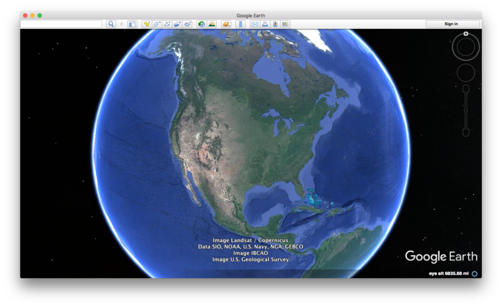
Credit: Google Earth
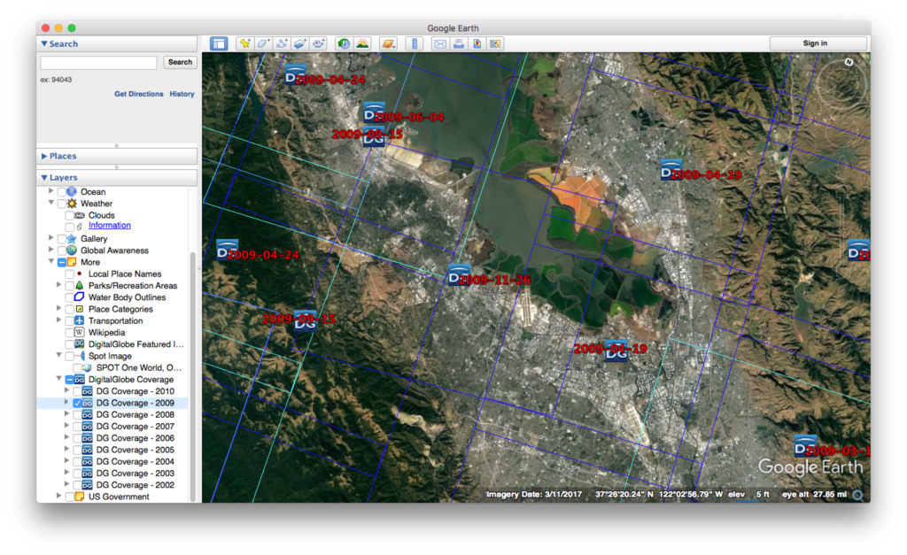
Credit: Google Earth
ESA Sentinal
There are five ESA Sentinel missions, each of which concentrate on different capabilities.
-
- First sign up for a Copernicus account using Open Hub.

Copernicus main page
- Let’s look at visible images (some infrared bands might be available)
- Install the Sentinel 2 – Toolbox
- Obtain an image through Copernicus.
- Load the image into the toolbox.
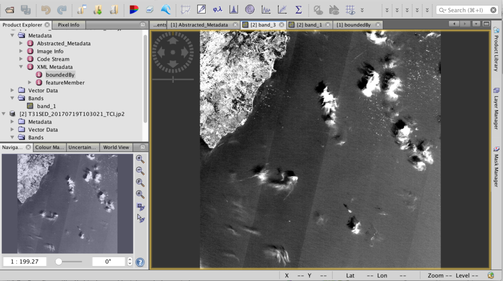
Sentinel Toolbox 2
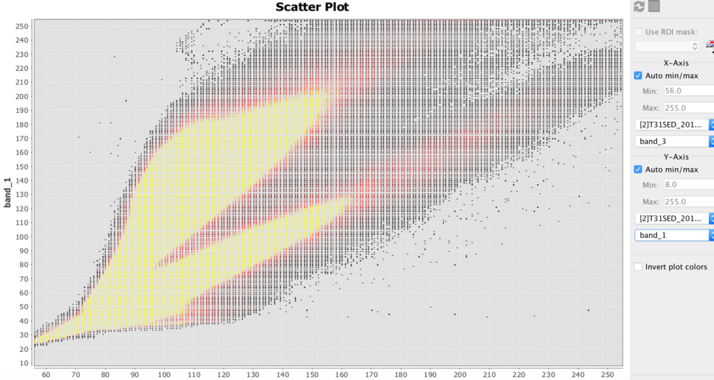
Sentinel Toolbox 2 scatter plot example
HDF
- HDF stands for hierarchical data file. It is used for some remote sensing files.
- Install HDFviewfor hierarchical data files (.h4, .h5, etc.)
- Download this file: BUV-Nimbus04_L3zm_v01-00-2012m0203t144121.h5.txt
- Open up this file in HDFview.
Hyperspectral Images and Analysis
Hyperspectral allows you to determine the materials viewed with much greater precision than most other methods. The amount of hyperspectral imagery available (especially for free) is quite limited, but the quantities should greatly increase in the next few years due to new missions by Satellogic and Planetary Resources.
The best way to learn how to use hyperspectral images is to download the TNPmips GIS software and go through the hyperspectral tutorial on that site.
- TNTmipsis GIS software that has a hyperspectral analysis component. There is a free version.
Further Reading
- Cubesats and Satellite Imagery (Corsbook)
-
7. Geographical Information Systems
Objectives
- Students will learn about geographical information systems as a tool to bring together various information sources to provide a better spatial understanding and visualization of historical phenomena.
- Finally, Geographical Information System (GIS) platforms will be explored. Open-source QGIS will be demonstrated.
- Cloud-based software, such as QGIS cloud, and cloud-based Map Editor will also be demonstrated.
Geographical Information Systems (GIS)
Geographical Information Systems (GIS) are ways to store, view and analyze information concerning areas of the Earth’s surface, such as a neighborhood, region, country or continent. They can even be used for oceans and even other planets.
GIS can be used to create maps, territorial diagrams and visualizations and even perform analysis. A software platform must be used for GIS. There are proprietary GIS platforms with lots of features such as ArcGIS. They cost money, but your university might have a subscription that you can use. You can sometimes get a free trial copy. There are also “open source” or lite versions that you can get for free, such at MIPS or QGIS. It is strongly recommended to go through the tutorial for at least one platform. Most platforms are somewhat similar, so if you know one platform reasonably well, then the others will make much more sense.
GIS breaks spatial information down into layers. For example, a base layer might comprise a satellite image. Another layer might superimpose roads and buildings. Another layer might contain labels and annotation. You might import a layer, such as the satellite image, then manually create other layers such as the annotation. There are many types of layers that you can import, sometime from the platform vendor, but often from other sources such as government sites.
Remember that the Earth is not flat! So unless you are working with a small area on the Earth’s surface, you will need to take into account the curvature of the layers you import or add. The larger the area, the greater the curvature becomes. Most GIS platforms will let you choose a coordinate system, but then you must make certain that the other lays will work with it.
Below is an example showing a map with the Hawaiian Island chain in the Pacific Ocean. To the left is a panel showing the available layers. You can choose which layers to display by checking them. Here, the counties (representing islands), cities and urban area layers have been selected. To the right, you can see those layers displayed. At the lower right hand corner, you can see the selected coordinate system.
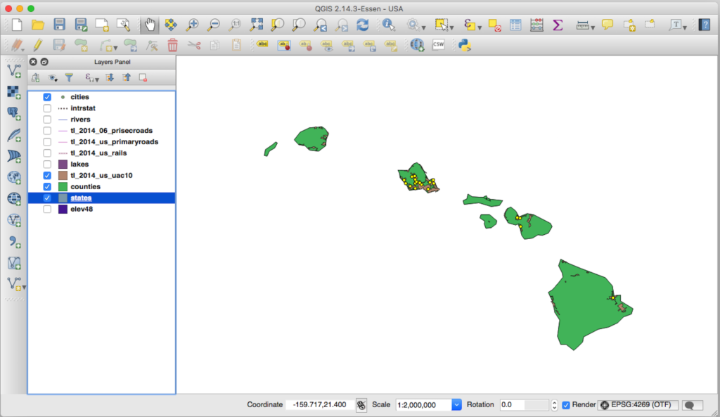
GIS view of Hawaii with cities and urban areas emphasized (QGIS)
Tryouts
Try out some of the platforms and tools in the workshop and make their own amazing discoveries. Participants will benefit from bringing their own laptop (ideally with a spreadsheet program installed and working wireless connectivity), but there will be activities that do not require technology.
GIS Software and Information
- QGIS open source GIS software – downloads
- TNT MIPS free GIS software with hyperspectral component – downloads
Activity
- Students will get as far as they can through a standard GIS tutorial in the time available.
Resources
- ArcGIS Story Maps.
-
8. Spatial Simulations and Programming
Objectives
- Students will learn about spatial simulations such as cellular automata, networks and geographic relationships and the tools to develop such simulations.
Scalable Vector Graphics (SVG)
Scalable Vector Graphics (SVG) is a language that can produce graphics. It works best to produce graphics with lines and shapes rather than photographic image. It works well to produce network diagrams.
The following is an example of SVG.
[code firstline=”1″ lang=”html”]</pre>
<svg width=”300″; height=”100″>
<circle cx=”50″ cy=”50″; r=”40″ stroke=”black” stroke-width=”4″ fill=”cyan”>
<circle cx=”200″ cy=”50″ r=”40″ stroke=”black” stroke-width=”4″ fill=”cyan”>
<line x1=”50″ y1=”50″ x2=”200″ y2=”50″ stroke=”blue” stroke-width=”2″>
<svg>
[/code]Scripting in JavaScript
Javascript is a scripting language that is executed in web pages. It can be included directly in html files, or it can be in its own file and referenced by the html file. Javascript is responsible for much of the interactivity you encounter in webpages. Javascript can manipulate many of the objects in a web page.
Generally Javascript must be enclosed in script tags.
Let’s explore a simple script included in an html page. Below is some HTML code for a button, followed by some Javascript code. Clicking the button will pop up an alert window displaying “Hello!”
[code lang=”html” firstline=”1″]
<button onclick=”myPopupBox()”> Click here</button>
<scrip> function myPopupBox() { alert(“Hello!”);}</script>
[/code]D3 JavaScript library
D3 can be used for visual simulations with some interactivity. D3 is a Javascript Library to produce animated data visualizations. It drives many of the data visualizations you see online, such as in the New York Times. D3 is relatively easy for some tasks, but not others. It is much easier to use D3 if you already know some Javascript.
Resource
- For more information, see the d3 site.
Activities
- Students will use Cellular to try out and manipulate several cellular automata simulations.
- Students will code a visual network, using a tool such as SVG.
Further Readings
- Scripting in JavaScript (Cosbook)
- SVG Tutorial (w3schools.com)
-
9. Gaming as a Form of Simulation
Objectives
Students will learn how games can be used as a form of historical simulation for both explorational and educational purposes. Students will examine how the need to make games marketable induces certain biases and misrepresentations that impact their historical accuracy.
Animations
Animations are one form of simulation. Animations are a series of artificially-created graphic images that are played in rapid succession to produce the illusion of change. Animations can be recordings of manually drawn and manipulated images. Or they can be graphic objects manipulated by a computer program.
Animations can involve maps that show the change or borders, or the movement of people. They can show environmental or social change, such as the spread of urbanization.
A simple form of animation is an animated GIF, which is a series of several digital images bound together in a GIF file. A more complicated form is Flash, a proprietary format. CSS also supports some animation, as does Java. Animations often involve plugins, such as Flash, to display on web pages.
Video
Videos can show an entire simulation or snippets. Video clips are sometimes used in games, and are often a good way for secondary storyboarding of a game. Some videos can now be filed in 3D to provide an interactive exploration experience.
Videos are a series of still images that are shown in rapid succession to present the illusion of movement. Videos can include actual photography (movies) and animations. Videos are different than animations that are produced on the fly by software, just as cinema is different from live theatrical performances. However, if generated animations or theistical performances are recorded, then the recording might be a video.
Videos are very useful to demonstrate changing graphical images or for portraying interviews. They are also better for mind control and emotional manipulation, because the movie maker controls the timing of what is seen.
Video to display on computers comes in two major categories of formats. One category is produced by proprietary software and required such to be viewed, such as the.cmprojfile produced by Camtasia. Another category are standard formats to be viewed by a broad range of browsers, software and devices, such as .mp4or .webm. Often you may produce the initial video in a proprietary format, then export it into standard formats.
Video is typically captured by a camera digitally or via film and then processed. (Some equipment can play original video recordings). You may yourself view videos in their raw form, but you will almost always want to edit and process them to show to others. Editing software such as Adobe Premier, Apple iMovie, or Camtasia, can edit video and output it in various forms. You may also wish to re-process the video for streaming over the web.
Game Psychology
Most games involve gamification attributes. For example, many games involve action with a focus on fights and battles. Players can earn points, property and special capabilities, hence providing a sense of accomplishment and “income” for effort performed. Many games allow for competition with other players and group recognition for success.
Critical Approach to Games
People generally play games for their entertainment value. However, generally, games are not reviewed by historical experts for authenticity. Even when they are, the games may nevertheless still contain distortions of historical facts and processes. As a historian, it is important to realize that history may not progress in the same manner as such games simulate.
Activities
- Students will present and discuss examples of historical games.
- Students will demonstrate such games if time permits.
Resources
-
10. 3-D Artifact Modeling, Preservation and Reproduction
Three Dimensional artifact modeling, preservation and reproduction
Objectives
- Students will learn how 3D scanning and printing can act as a means of historical artifact preservation and reproduction.
The Technology
3D printing can either create a physical object from a digital design file or from scans and photographs of pre-existing physical objects. 3D printers print objects one “slice” or layer at a time, usually beginning at the bottom and building upwards. Most common 3D printers print in plastic which can be easily melted and channeled, but other materials can be used such as metals, resins, gypsum and even chocolate, but not on the same printer!
Special software can take scans or photos of physical objects and stitch the images together into a three-dimensional object. Often this approach produces sufficient qualities, but sometimes it can produces irregularities. For better precision, a three-dimensional scanner should be used, or place the object on a turntable to ensure more consistent positioning.
For cases where the object is hypothetical or is not physically available, an object can be designed in drawing software called Computer-Aided Design (CAD).

3D printer printing a chess piece (credit: 3D Systems)
Activities
- Students will use the SFSU Library maker space to 3D scan a sample historical object.
- Students will model a historical object using a simple, online CAD tool such as Tinker CAD.
- Students will use their university’s maker space to print a 3D historical object (either from the scan or their model).
Resources
- Tinkercad free online CAD software
-
11. Immersion In History with Virtual Reality
Learning Objectives
- Students will learn about various types of virtual reality such as animated and real life imagery, the challenges in developing VR experiences, and the tools to do so.
Virtual Reality is Literally 3D Printing Inside Out
Virtual Reality (VR) allows a user to view graphic content in three dimensions, and move about the graphics. Typically virtual reality provides stereographic capability, so the user feels depth perception. Oculus makes dedicated virtual reality goggles. Samsung makes a headset that can convert an Android phone into a VR headset.
VR can be even used on ordinary laptop, tablet and phone screens. Although the experience does not use stereoscopy to produce 3D effects, one can still explore in three dimensions. For example, see the below example.
Roman Theater in Petra, Jordan (credit: Sitoo, CC BY-NC-ND 2.0)
Activities
- Students will gain exposure to several virtual experiences in their university’s maker space.
- Students will storyboard a concept for a VR experience.
Further Reading
- Berlin Wall virtual reality example
-
12. The Future of Digital History
Who can say for certain what paths digital history will take in the future. More sources will likely be digitalized. Whether such sources will be freely available or restricted behind paywalls or policies remains to be seen. Virtual reality will likely move us further and further into The Matrix. Gaming and other technologies allow us to literally create and change history. The only thing certain is that there will be new technologies and new uses.